Missouri Landmarks Map
A free printable illustrated map of Missouri for kids. It shows 9 landmarks and natural places and 3 industries where they really are, along with the state symbols, 6 cities and a box of key facts. It comes in color and in ink-saving black and white, sized for US Letter paper.
downloadColor PDF downloadBlack and white PDF
Choose your version
Color or black and white.
Both are free, sized for US Letter paper, and come as a PDF to print or a PNG image for slides.
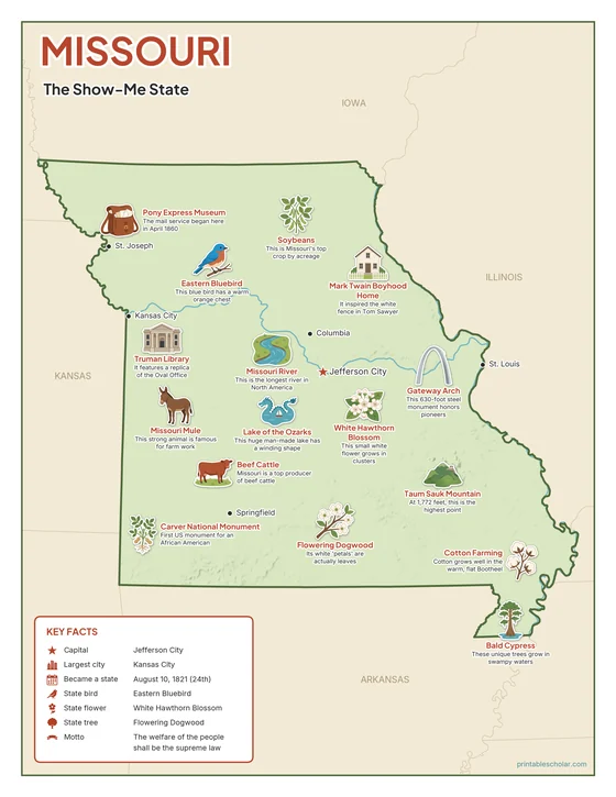
Color
The full-color map, for a wall display or a color printer.

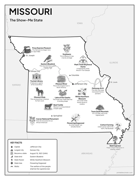
Black and white
The same map with no color or shading. Prints cleanly on a classroom printer and saves ink.

What is on the Missouri map
Every picture sits at its real location in Missouri, with a one-line fact beside it. Jefferson City, the capital, is marked with a star.
Landmarks and natural places
- Missouri River: This is the longest river in North America.
- Lake of the Ozarks: This huge man-made lake has a winding shape.
- Taum Sauk Mountain: At 1,772 feet, this is the highest point.
- Bald Cypress: These unique trees grow in swampy waters.
- Gateway Arch: This 630-foot steel monument honors pioneers.
- Mark Twain Boyhood Home: It inspired the white fence in Tom Sawyer.
- Pony Express Museum: The mail service began here in April 1860.
- Carver National Monument: First US monument for an African American.
- Truman Library: It features a replica of the Oval Office.
What Missouri makes and grows
- Soybeans: This is Missouri’s top crop by acreage.
- Beef Cattle: Missouri is a top producer of beef cattle.
- Cotton Farming: Cotton grows well in the warm, flat Bootheel.
State symbols
- Eastern Bluebird: This blue bird has a warm orange chest.
- Flowering Dogwood: Its white ’petals’ are actually leaves.
- White Hawthorn Blossom: This small white flower grows in clusters.
- Missouri Mule: This strong animal is famous for farm work.
Missouri key facts
From the box on the map
- Nickname
- The Show-Me State
- Capital
- Jefferson City
- Largest city
- Kansas City
- Became a state
- August 10, 1821 (24th)
- State bird
- Eastern Bluebird
- State flower
- White Hawthorn Blossom
- State tree
- Flowering Dogwood
- Motto
- The welfare of the people shall be the supreme law
Cities shown
- Jefferson City (capital)
- Kansas City
- St. Louis
- Springfield
- Columbia
- St. Joseph
The outline, rivers and cities are drawn from map data. Pictures of crops and industries are placed in a part of the state where each is typical.