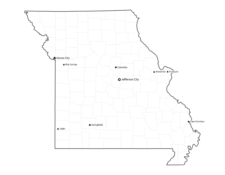
Free Printable Missouri Map with Cities
Free printable map of Missouri showing major cities, the state capital Jefferson City, and county boundaries. Perfect for geography study, classroom use, and reference.
About This Missouri Map
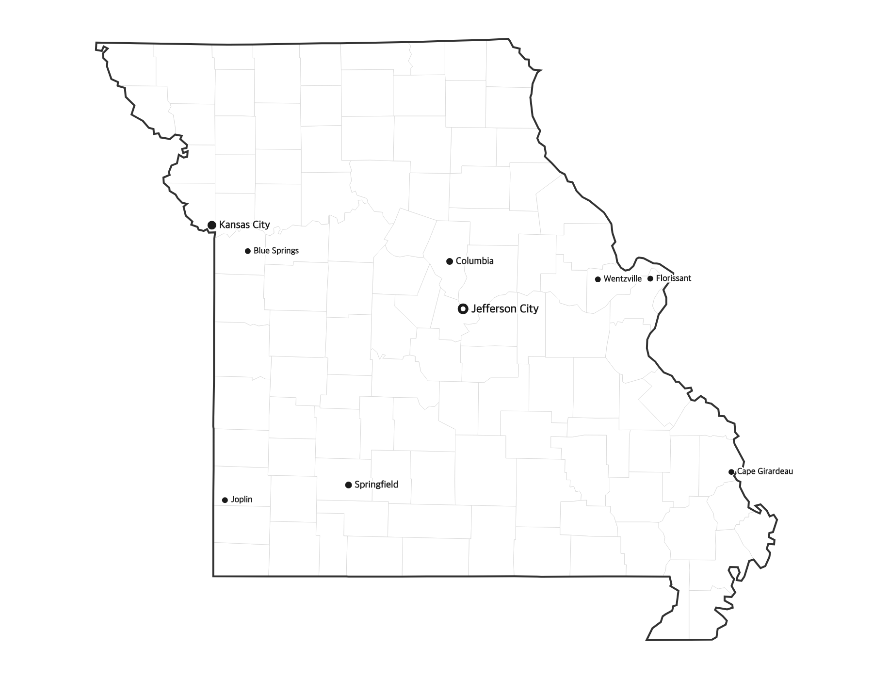
This free printable map of Missouri shows the state's major cities, including Kansas City, Springfield, Columbia, Independence, Blue Springs, along with the state capital Jefferson City (marked in red). County boundaries are shown as light lines for geographic context. Missouri, known as the "Show-Me State," has 115 counties.
How to Print
Click "Download PDF" for a print-ready file that automatically fits US Letter paper (8.5" × 11") with proper margins. Or download the high-resolution PNG to use in presentations, worksheets, or other documents.
Classroom Ideas
Use this map as a study reference or desk reference for Missouri geography. Pair it with our blank Missouri map for testing — students label cities and the capital from memory, then check against this reference.
Cities on This Missouri Map
This map labels Missouri's largest cities, including Kansas City (the state's biggest city) in the west and St. Louis on the Mississippi River in the east, plus Springfield in the Ozarks, the university town of Columbia, and Kansas City suburbs like Independence and Lee's Summit. The state capital, Jefferson City, is marked with a red dot near the center of the state.
Missouri Geography at a Glance
Missouri sits where the Midwest meets the South, and it borders eight states — tied with Tennessee for the most in the country: Iowa to the north; Illinois, Kentucky, and Tennessee to the east across the Mississippi River; Arkansas to the south; and Oklahoma, Kansas, and Nebraska to the west. The Missouri River cuts across the state and joins the Mississippi near St. Louis. The rolling Ozark Plateau covers the south, while flatter plains stretch across the north.
Teaching Ideas for This Map
Have students trace the Missouri and Mississippi rivers to the point where they meet, count the eight bordering states, or locate the capital and their nearest city. Pair this reference with the blank Missouri map so learners can label the 114 counties and the capital from memory, then self-check.
Frequently Asked Questions
What are the largest cities in Missouri?
The largest cities in Missouri by population include Kansas City, Springfield, Columbia, Independence, Blue Springs. The state capital is Jefferson City.
What is the capital of Missouri?
The capital of Missouri is Jefferson City. It is marked with a red dot on this map.
What paper size should I use?
This map is designed for standard US Letter paper (8.5" × 11"). The PDF download automatically fits the map to your page with proper margins.
How many counties does Missouri have?
Missouri has 114 counties plus one independent city, St. Louis, which is not part of any county. The capital, Jefferson City, is in Cole County.
How many states border Missouri?
Missouri borders eight states — Iowa, Illinois, Kentucky, Tennessee, Arkansas, Oklahoma, Kansas, and Nebraska — tying Tennessee for the most of any U.S. state.
What is the largest city in Missouri?
Kansas City is the largest city in Missouri, followed by St. Louis. The capital is Jefferson City, which is much smaller than either.