Mississippi Landmarks Map
A free printable illustrated map of Mississippi for kids. It shows 7 landmarks and natural places and 4 industries where they really are, along with the state symbols, 6 cities and a box of key facts. It comes in color and in ink-saving black and white, sized for US Letter paper.
downloadColor PDF downloadBlack and white PDF
Choose your version
Color or black and white.
Both are free, sized for US Letter paper, and come as a PDF to print or a PNG image for slides.
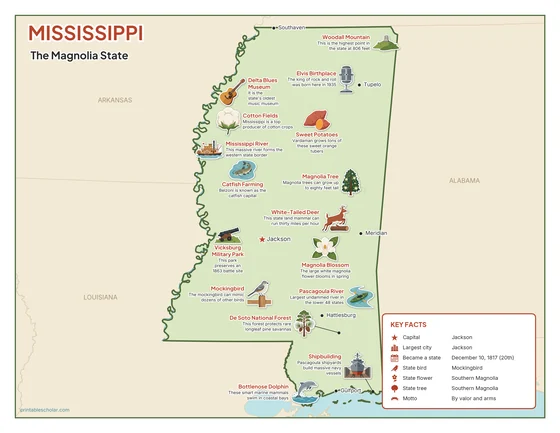
Color
The full-color map, for a wall display or a color printer.

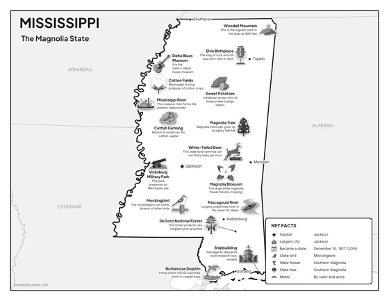
Black and white
The same map with no color or shading. Prints cleanly on a classroom printer and saves ink.

What is on the Mississippi map
Every picture sits at its real location in Mississippi, with a one-line fact beside it. Jackson, the capital, is marked with a star.
Landmarks and natural places
- Mississippi River: This massive river forms the western state border.
- Woodall Mountain: This is the highest point in the state at 806 feet.
- Pascagoula River: Largest undammed river in the lower 48 states.
- De Soto National Forest: This forest protects rare longleaf pine savannas.
- Elvis Birthplace: The king of rock and roll was born here in 1935.
- Delta Blues Museum: It is the state’s oldest music museum.
- Vicksburg Military Park: This park preserves an 1863 battle site.
What Mississippi makes and grows
- Catfish Farming: Belzoni is known as the catfish capital.
- Cotton Fields: Mississippi is a top producer of cotton crops.
- Shipbuilding: Pascagoula shipyards build massive navy vessels.
- Sweet Potatoes: Vardaman grows tons of these sweet orange tubers.
State symbols
- Mockingbird: The mockingbird can mimic dozens of other birds.
- Magnolia Blossom: The large white magnolia flower blooms in spring.
- Magnolia Tree: Magnolia trees can grow up to eighty feet tall.
- White-Tailed Deer: This state land mammal can run thirty miles per hour.
- Bottlenose Dolphin: These smart marine mammals swim in coastal bays.
Mississippi key facts
From the box on the map
- Nickname
- The Magnolia State
- Capital
- Jackson
- Largest city
- Jackson
- Became a state
- December 10, 1817 (20th)
- State bird
- Mockingbird
- State flower
- Southern Magnolia
- State tree
- Southern Magnolia
- Motto
- By valor and arms
Cities shown
- Jackson (capital)
- Gulfport
- Southaven
- Hattiesburg
- Meridian
- Tupelo
The outline, rivers and cities are drawn from map data. Pictures of crops and industries are placed in a part of the state where each is typical.