Louisiana Landmarks Map
A free printable illustrated map of Louisiana for kids. It shows 8 landmarks and natural places and 4 industries where they really are, along with the state symbols, 6 cities and a box of key facts. It comes in color and in ink-saving black and white, sized for US Letter paper.
downloadColor PDF downloadBlack and white PDF
Choose your version
Color or black and white.
Both are free, sized for US Letter paper, and come as a PDF to print or a PNG image for slides.
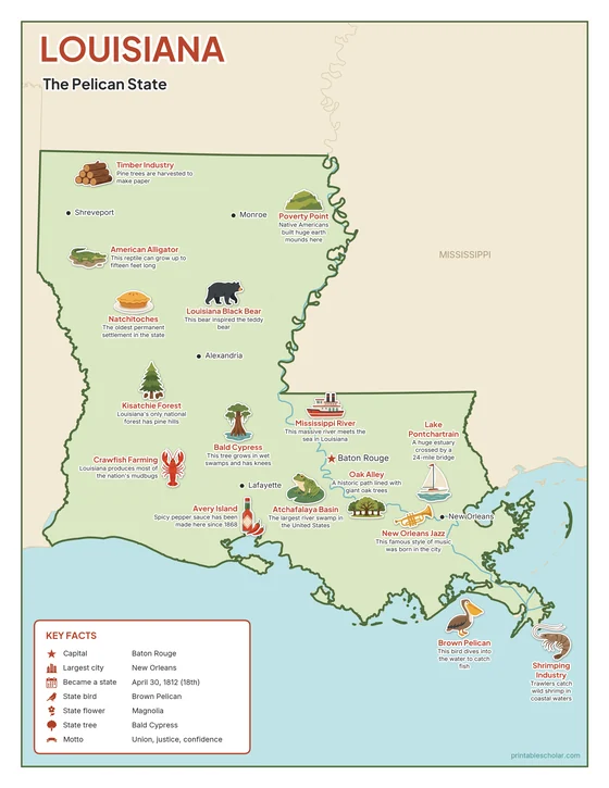
Color
The full-color map, for a wall display or a color printer.

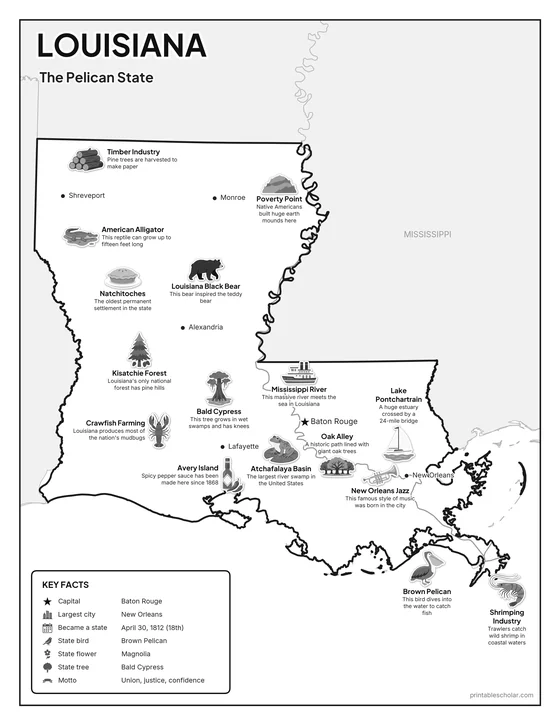
Black and white
The same map with no color or shading. Prints cleanly on a classroom printer and saves ink.

What is on the Louisiana map
Every picture sits at its real location in Louisiana, with a one-line fact beside it. Baton Rouge, the capital, is marked with a star.
Landmarks and natural places
- Poverty Point: Native Americans built huge earth mounds here.
- Kisatchie Forest: Louisiana’s only national forest has pine hills.
- Natchitoches: The oldest permanent settlement in the state.
- Atchafalaya Basin: The largest river swamp in the United States.
- Oak Alley: A historic path lined with giant oak trees.
- Mississippi River: This massive river meets the sea in Louisiana.
- Lake Pontchartrain: A huge estuary crossed by a 24-mile bridge.
- New Orleans Jazz: This famous style of music was born in the city.
What Louisiana makes and grows
- Timber Industry: Pine trees are harvested to make paper.
- Crawfish Farming: Louisiana produces most of the nation’s mudbugs.
- Avery Island: Spicy pepper sauce has been made here since 1868.
- Shrimping Industry: Trawlers catch wild shrimp in coastal waters.
State symbols
- Louisiana Black Bear: This bear inspired the teddy bear.
- American Alligator: This reptile can grow up to fifteen feet long.
- Bald Cypress: This tree grows in wet swamps and has knees.
- Brown Pelican: This bird dives into the water to catch fish.
Louisiana key facts
From the box on the map
- Nickname
- The Pelican State
- Capital
- Baton Rouge
- Largest city
- New Orleans
- Became a state
- April 30, 1812 (18th)
- State bird
- Brown Pelican
- State flower
- Magnolia
- State tree
- Bald Cypress
- Motto
- Union, justice, confidence
Cities shown
- Baton Rouge (capital)
- New Orleans
- Shreveport
- Lafayette
- Alexandria
- Monroe
The outline, rivers and cities are drawn from map data. Pictures of crops and industries are placed in a part of the state where each is typical.