 Printable Scholar
Korean War Map
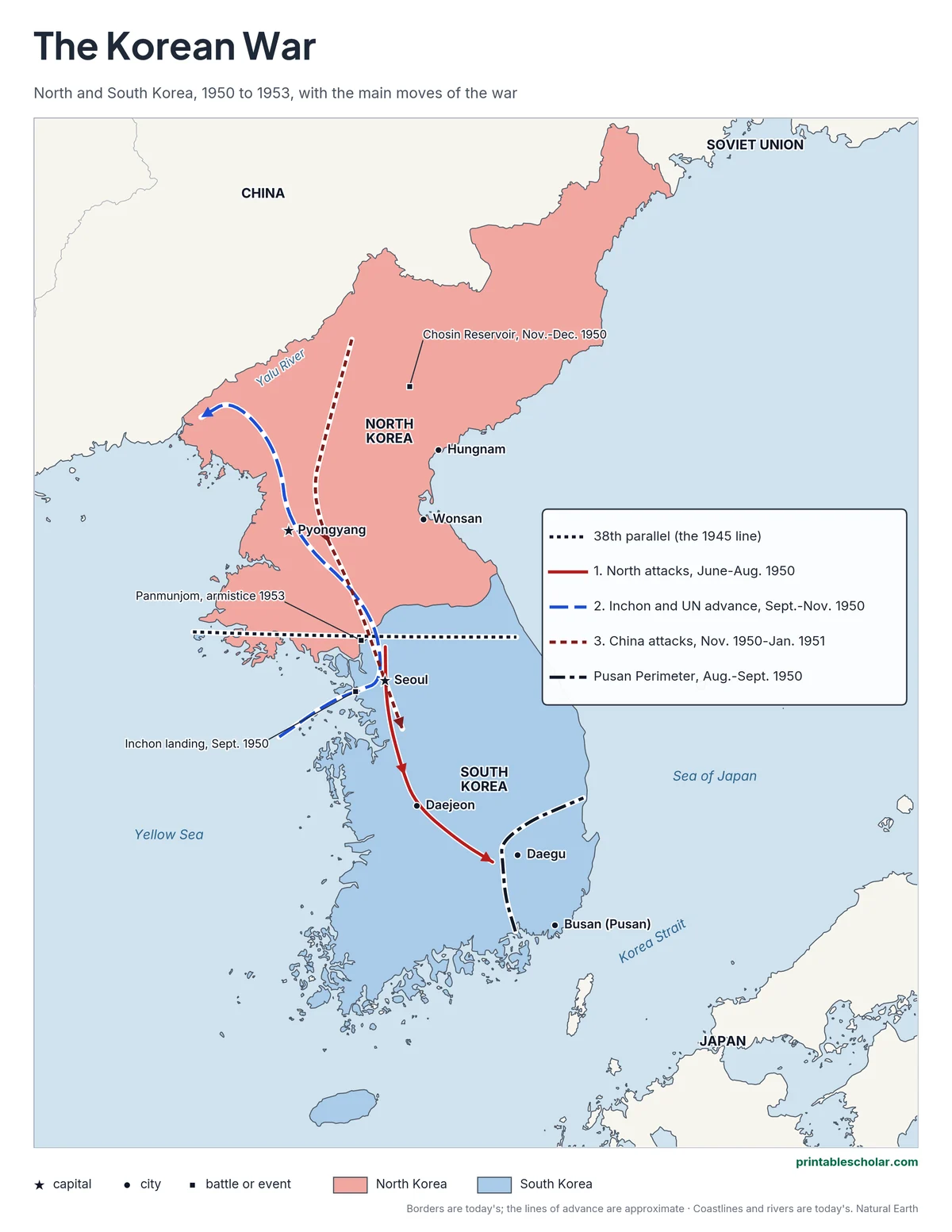
A free printable map of the Korean War, showing North and South Korea, the 38th parallel, the three great moves of the war in 1950 and 1951, and the battles and places students learn: the Pusan Perimeter, the Inchon landing, the Chosin Reservoir and Panmunjom. It comes in color, black and white, and blank.
Choose your version
Black and white, color or blank.
All three are free PDFs sized for US Letter paper.

Black and white
Everything named on a plain outline map with no terrain. No color ink needed.
downloadBlack and white PDF
Color
North and South, the moves of the war, cities and battles named.
downloadColor PDF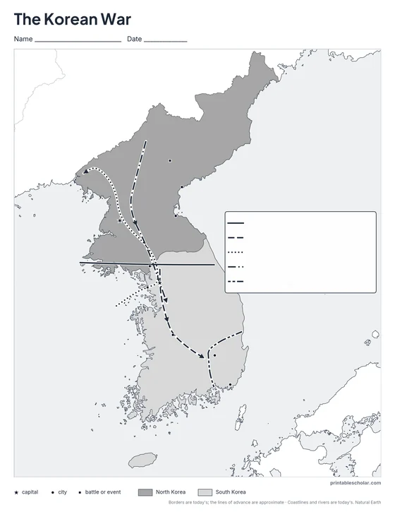
Blank
The black-and-white map with its routes and markers but no names, for labeling practice.
downloadBlank PDFKorea at war
At the end of World War II, in 1945, Korea was divided at the 38th parallel of latitude: Soviet troops held the North and American troops the South. In 1948 two governments formed, a communist North with its capital at Pyongyang and a South with its capital at Seoul. On June 25, 1950, North Korea’s army crossed the 38th parallel and invaded the South. It took Seoul within days and pushed the South Korean and American forces back to a small corner around the port of Busan, the Pusan Perimeter. The United Nations sent troops from 16 countries, led by the United States. In September 1950 General Douglas MacArthur landed an army behind the North Korean lines at Inchon, near Seoul, and UN forces drove north past Pyongyang toward the Yalu River, the border with China. In late October and November, hundreds of thousands of Chinese soldiers entered the war. They pushed the UN forces back south of Seoul; at the Chosin Reservoir, American Marines fought their way out through bitter cold to the port of Hungnam. The front then settled near the 38th parallel, and for two more years the armies fought over hills and ridges while the two sides talked. An armistice was signed at Panmunjom on July 27, 1953. No peace treaty was ever signed, and a demilitarized zone, the DMZ, still divides Korea today.
On the map
- Seoul and Pyongyang: the capitals of South and North Korea
- The 38th parallel: the line drawn in 1945
- Pusan Perimeter, August to September 1950: the corner the UN forces held
- Inchon, September 1950: the landing behind North Korean lines
- Chosin Reservoir, November to December 1950: a battle in bitter cold
- Panmunjom: where the armistice was signed, July 27, 1953
Find it on the map
- How close Seoul is to the 38th parallel
- The Yalu River, the border with China
- The small corner around Busan the UN forces held in 1950
The moves of the war are drawn as simple arrows and are approximate. Borders are today’s; the 1953 armistice line is close to today’s border. Coastlines and rivers are shown as they are today.
Frequently asked questions
What started the Korean War?
North Korea’s army invaded South Korea across the 38th parallel on June 25, 1950, aiming to unite the country under the North’s communist government.
What is the 38th parallel?
The line of latitude 38 degrees north of the equator, where Korea was divided in 1945. The war began when North Korea crossed it, and the front ended up near it in 1953.
Who fought in the Korean War?
North Korea and, from late 1950, China, supplied by the Soviet Union, against South Korea and United Nations forces from 16 countries, most of them American.
How did the Korean War end?
With an armistice, a cease-fire, signed at Panmunjom on July 27, 1953. No peace treaty was signed, and the demilitarized zone, the DMZ, still divides North and South Korea.
How do students use the blank map?
The blank map keeps the arrows, the 38th parallel and the city and battle markers with no names. Students label the capitals, battles and places and explain each move of the war. The labeled map is the answer key.