Illinois Landmarks Map
A free printable illustrated map of Illinois for kids. It shows 8 landmarks and natural places and 4 industries where they really are, along with the state symbols, 6 cities and a box of key facts. It comes in color and in ink-saving black and white, sized for US Letter paper.
downloadColor PDF downloadBlack and white PDF
Choose your version
Color or black and white.
Both are free, sized for US Letter paper, and come as a PDF to print or a PNG image for slides.
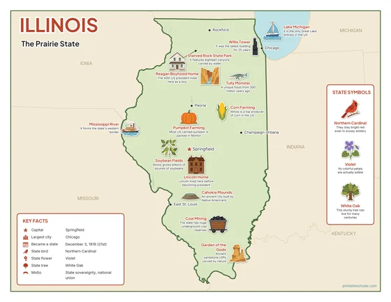
Color
The full-color map, for a wall display or a color printer.

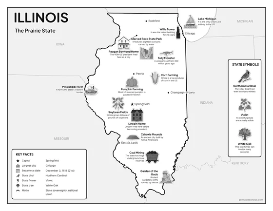
Black and white
The same map with no color or shading. Prints cleanly on a classroom printer and saves ink.

What is on the Illinois map
Every picture sits at its real location in Illinois, with a one-line fact beside it. Springfield, the capital, is marked with a star.
Landmarks and natural places
- Lake Michigan: It is the only Great Lake entirely in the US.
- Mississippi River: It forms the state’s western border.
- Garden of the Gods: Ancient sandstone cliffs carved by nature.
- Starved Rock State Park: It features eighteen canyons carved by water.
- Lincoln Home: Lincoln lived here before becoming president.
- Cahokia Mounds: An ancient city built by Native Americans.
- Willis Tower: It was the tallest building for 25 years.
- Reagan Boyhood Home: The 40th US president lived here as a boy.
What Illinois makes and grows
- Corn Farming: Illinois is a top producer of corn in the US.
- Soybean Fields: Illinois grows billions of pounds of soybeans.
- Coal Mining: The state has huge underground coal reserves.
- Pumpkin Farming: Most US canned pumpkin is packed in Morton.
State symbols
- Northern Cardinal: They stay bright red even in snowy winters.
- Violet: Its colorful petals are actually edible.
- White Oak: This sturdy tree can live for many centuries.
- Tully Monster: A unique fossil from 300 million years ago.
Illinois key facts
From the box on the map
- Nickname
- The Prairie State
- Capital
- Springfield
- Largest city
- Chicago
- Became a state
- December 3, 1818 (21st)
- State bird
- Northern Cardinal
- State flower
- Violet
- State tree
- White Oak
- Motto
- State sovereignty, national union
Cities shown
- Chicago
- Springfield (capital)
- Rockford
- Peoria
- Champaign-Urbana
- East St. Louis
The outline, rivers and cities are drawn from map data. Pictures of crops and industries are placed in a part of the state where each is typical.