Hawaii Landmarks Map
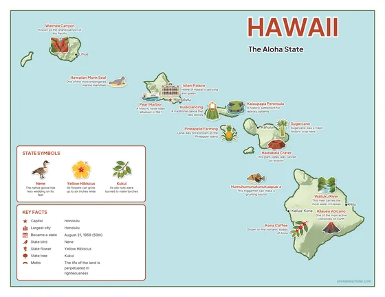
A free printable illustrated map of Hawaii for kids. It shows 8 landmarks and natural places and 3 industries where they really are, along with the state symbols, 5 cities and a box of key facts. It comes in color and in ink-saving black and white, sized for US Letter paper.
downloadColor PDF downloadBlack and white PDF
Choose your version
Color or black and white.
Both are free, sized for US Letter paper, and come as a PDF to print or a PNG image for slides.
Color
The full-color map, for a wall display or a color printer.

Black and white
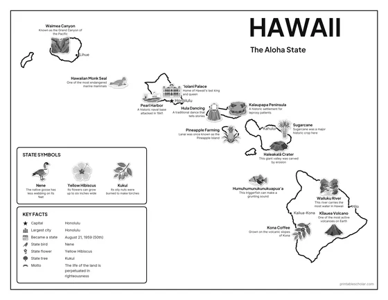
The same map with no color or shading. Prints cleanly on a classroom printer and saves ink.

What is on the Hawaii map
Every picture sits at its real location in Hawaii, with a one-line fact beside it. Honolulu, the capital, is marked with a star.
Landmarks and natural places
- Kīlauea Volcano: One of the most active volcanoes on Earth.
- Waimea Canyon: Known as the Grand Canyon of the Pacific.
- Haleakalā Crater: This giant valley was carved by erosion.
- Wailuku River: This river carries the most water in Hawaii.
- Pearl Harbor: A historic naval base attacked in 1941.
- ‘Iolani Palace: Home of Hawaii’s last king and queen.
- Kalaupapa Peninsula: A historic settlement for leprosy patients.
- Hula Dancing: A traditional dance that tells stories.
What Hawaii makes and grows
- Pineapple Farming: Lanai was once known as the Pineapple Island.
- Kona Coffee: Grown on the volcanic slopes of Kona.
- Sugarcane: Sugarcane was a major historic crop here.
State symbols
- Nene: The native goose has less webbing on its feet.
- Yellow Hibiscus: Its flowers can grow up to six inches wide.
- Kukui: Its oily nuts were burned to make torches.
- Humuhumunukunukuapua‘a: This triggerfish can make a grunting sound.
- Hawaiian Monk Seal: One of the most endangered marine mammals.
Hawaii key facts
From the box on the map
- Nickname
- The Aloha State
- Capital
- Honolulu
- Largest city
- Honolulu
- Became a state
- August 21, 1959 (50th)
- State bird
- Nene
- State flower
- Yellow Hibiscus
- State tree
- Kukui
- Motto
- The life of the land is perpetuated in righteousness
Cities shown
- Honolulu (capital)
- Hilo
- Kailua-Kona
- Kahului
- Lihue
The outline, rivers and cities are drawn from map data. Pictures of crops and industries are placed in a part of the state where each is typical.