Connecticut Landmarks Map
A free printable illustrated map of Connecticut for kids. It shows 8 landmarks and natural places and 4 industries where they really are, along with the state symbols, 6 cities and a box of key facts. It comes in color and in ink-saving black and white, sized for US Letter paper.
downloadColor PDF downloadBlack and white PDF
Choose your version
Color or black and white.
Both are free, sized for US Letter paper, and come as a PDF to print or a PNG image for slides.
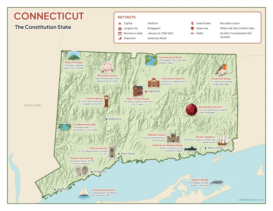
Color
The full-color map, for a wall display or a color printer.

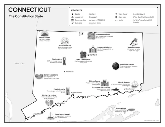
Black and white
The same map with no color or shading. Prints cleanly on a classroom printer and saves ink.

What is on the Connecticut map
Every picture sits at its real location in Connecticut, with a one-line fact beside it. Hartford, the capital, is marked with a star.
Landmarks and natural places
- Connecticut River: The longest river in the New England region.
- Candlewood Lake: The largest lake in Connecticut is man-made.
- Mount Frissell: The state’s highest point is on its slope.
- Long Island Sound: A large estuary bordering the southern coast.
- Yale University: An Ivy League school founded in 1701.
- Mark Twain House: The famous author lived here for 17 years.
- Mystic Seaport: A famous museum of ships and seafaring life.
- Gillette Castle: A stone castle built by a famous actor.
What Connecticut makes and grows
- Submarine Shipbuilding: Groton is known as the submarine capital.
- Insurance Industry: Hartford is a global hub for insurance.
- Oyster Harvesting: Connecticut farms 70,000 acres of shellfish.
- Clockmaking: Eli Terry mass-produced wooden clocks here.
State symbols
- American Robin: It is famous for laying bright blue eggs.
- Mountain Laurel: Native Americans made spoons from its wood.
- Sperm Whale: It is the largest toothed whale in the world.
- Almandine Garnet: This red gemstone is used to make sandpaper.
Connecticut key facts
From the box on the map
- Nickname
- The Constitution State
- Capital
- Hartford
- Largest city
- Bridgeport
- Became a state
- January 9, 1788 (5th)
- State bird
- American Robin
- State flower
- Mountain Laurel
- State tree
- White Oak (the Charter Oak)
- Motto
- He Who Transplanted Still Sustains
Cities shown
- Hartford (capital)
- Bridgeport
- New Haven
- Stamford
- Waterbury
- New London
The outline, rivers and cities are drawn from map data. Pictures of crops and industries are placed in a part of the state where each is typical.