Alaska Landmarks Map
A free printable illustrated map of Alaska for kids. It shows 8 landmarks and natural places and 4 industries where they really are, along with the state symbols, 6 cities and a box of key facts. It comes in color and in ink-saving black and white, sized for US Letter paper.
downloadColor PDF downloadBlack and white PDF
Choose your version
Color or black and white.
Both are free, sized for US Letter paper, and come as a PDF to print or a PNG image for slides.
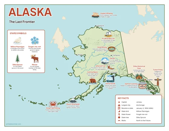
Color
The full-color map, for a wall display or a color printer.

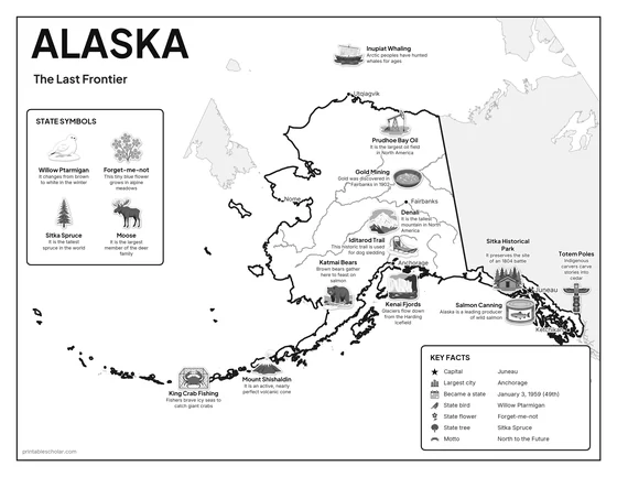
Black and white
The same map with no color or shading. Prints cleanly on a classroom printer and saves ink.

What is on the Alaska map
Every picture sits at its real location in Alaska, with a one-line fact beside it. Juneau, the capital, is marked with a star.
Landmarks and natural places
- Denali: It is the tallest mountain in North America.
- Katmai Bears: Brown bears gather here to feast on salmon.
- Kenai Fjords: Glaciers flow down from the Harding Icefield.
- Mount Shishaldin: It is an active, nearly perfect volcanic cone.
- Iditarod Trail: This historic trail is used for dog sledding.
- Totem Poles: Indigenous carvers carve stories into cedar.
- Sitka Historical Park: It preserves the site of an 1804 battle.
- Inupiat Whaling: Arctic peoples have hunted whales for ages.
What Alaska makes and grows
- Prudhoe Bay Oil: It is the largest oil field in North America.
- King Crab Fishing: Fishers brave icy seas to catch giant crabs.
- Gold Mining: Gold was discovered in Fairbanks in 1902.
- Salmon Canning: Alaska is a leading producer of wild salmon.
State symbols
- Willow Ptarmigan: It changes from brown to white in the winter.
- Forget-me-not: This tiny blue flower grows in alpine meadows.
- Sitka Spruce: It is the tallest spruce in the world.
- Moose: It is the largest member of the deer family.
Alaska key facts
From the box on the map
- Nickname
- The Last Frontier
- Capital
- Juneau
- Largest city
- Anchorage
- Became a state
- January 3, 1959 (49th)
- State bird
- Willow Ptarmigan
- State flower
- Forget-me-not
- State tree
- Sitka Spruce
- Motto
- North to the Future
Cities shown
- Juneau (capital)
- Anchorage
- Fairbanks
- Nome
- Utqiagvik
- Ketchikan
The outline, rivers and cities are drawn from map data. Pictures of crops and industries are placed in a part of the state where each is typical.