Virginia Landmarks Map
A free printable illustrated map of Virginia for kids. It shows 8 landmarks and natural places and 4 industries where they really are, along with the state symbols, 6 cities and a box of key facts. It comes in color and in ink-saving black and white, sized for US Letter paper.
downloadColor PDF downloadBlack and white PDF
Choose your version
Color or black and white.
Both are free, sized for US Letter paper, and come as a PDF to print or a PNG image for slides.
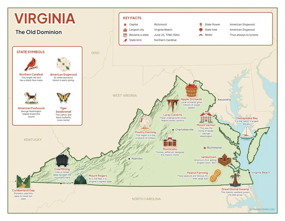
Color
The full-color map, for a wall display or a color printer.

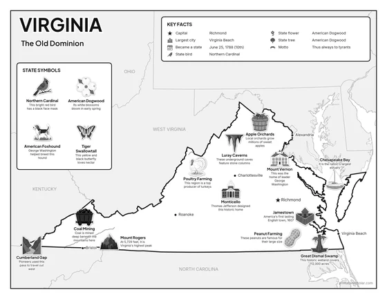
Black and white
The same map with no color or shading. Prints cleanly on a classroom printer and saves ink.

What is on the Virginia map
Every picture sits at its real location in Virginia, with a one-line fact beside it. Richmond, the capital, is marked with a star.
Landmarks and natural places
- Chesapeake Bay: It is the nation’s largest estuary.
- Great Dismal Swamp: This historic wetland covers 112,000 acres.
- Mount Rogers: At 5,729 feet, it is Virginia’s highest peak.
- Luray Caverns: These underground caves feature stone columns.
- Jamestown: America’s first lasting English town, 1607.
- Mount Vernon: This was the home of leader George Washington.
- Monticello: Thomas Jefferson designed this historic home.
- Cumberland Gap: Pioneers used this pass to travel out west.
What Virginia makes and grows
- Coal Mining: Coal is mined deep beneath the mountains here.
- Peanut Farming: These peanuts are famous for their large size.
- Apple Orchards: Local orchards grow millions of sweet apples.
- Poultry Farming: This region is a top producer of turkeys.
State symbols
- Northern Cardinal: This bright red bird has a black face mask.
- American Dogwood: Its white blossoms bloom in early spring.
- American Foxhound: George Washington helped breed this hound.
- Tiger Swallowtail: This yellow and black butterfly loves nectar.
Virginia key facts
From the box on the map
- Nickname
- The Old Dominion
- Capital
- Richmond
- Largest city
- Virginia Beach
- Became a state
- June 25, 1788 (10th)
- State bird
- Northern Cardinal
- State flower
- American Dogwood
- State tree
- American Dogwood
- Motto
- Thus always to tyrants
Cities shown
- Richmond (capital)
- Virginia Beach
- Alexandria
- Roanoke
- Charlottesville
- Bristol
The outline, rivers and cities are drawn from map data. Pictures of crops and industries are placed in a part of the state where each is typical.