Free Printable Pennsylvania Map with Cities
Free printable map of Pennsylvania showing major cities, the state capital Harrisburg, and county boundaries. Perfect for geography study, classroom use, and reference.

About This Pennsylvania Map
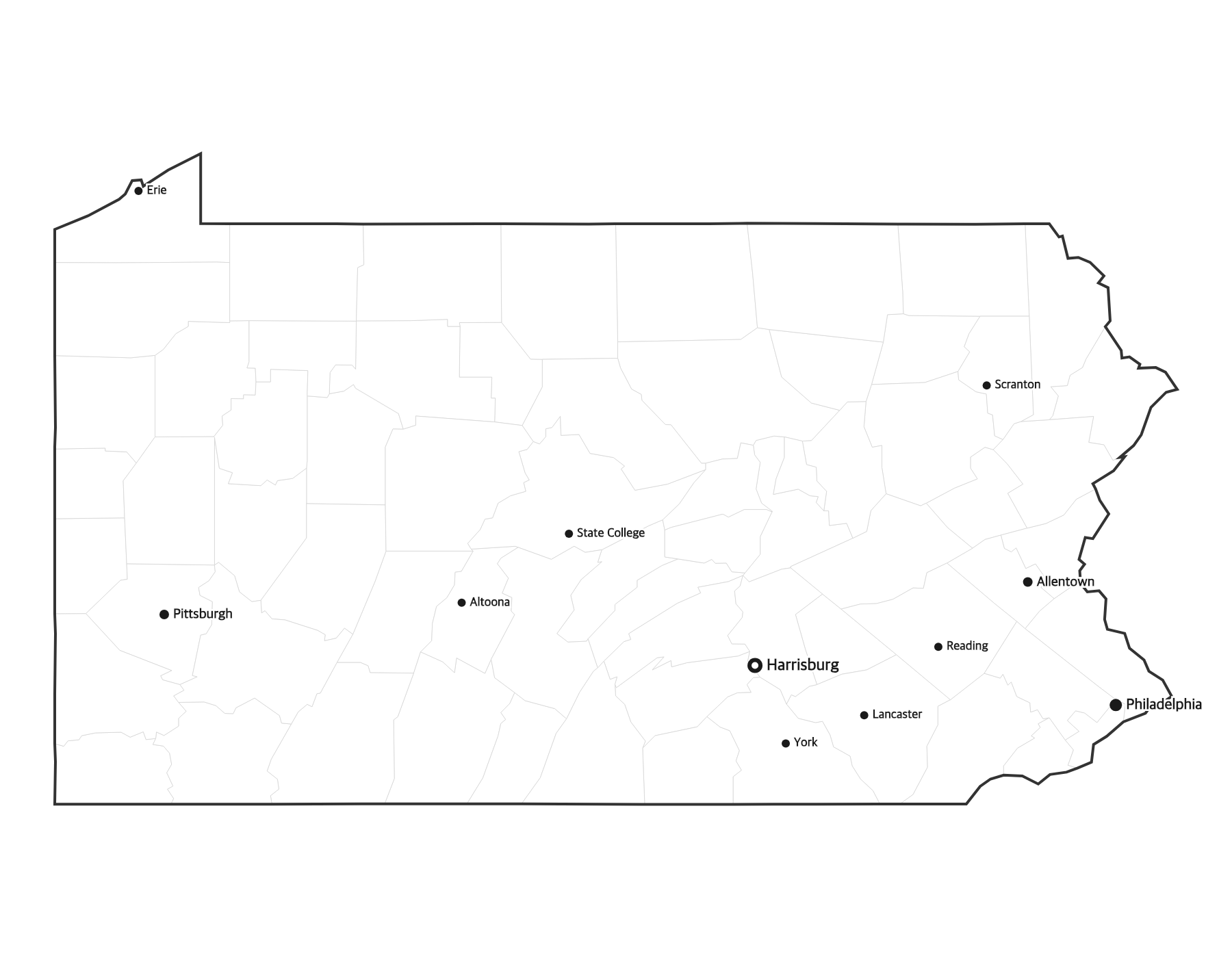
This free printable map of Pennsylvania shows the state's major cities, including Philadelphia, Pittsburgh, Allentown, Reading, Erie, along with the state capital Harrisburg (marked in red). County boundaries are shown as light lines for geographic context. Pennsylvania, known as the "Keystone State," has 67 counties.
How to Print
Click "Download PDF" for a print-ready file that automatically fits US Letter paper (8.5" × 11") with proper margins. Or download the high-resolution PNG to use in presentations, worksheets, or other documents.
Classroom Ideas
Use this map as a study reference or desk reference for Pennsylvania geography. Pair it with our blank Pennsylvania map for testing — students label cities and the capital from memory, then check against this reference.
Cities on This Pennsylvania Map
This map labels Pennsylvania's largest cities, led by Philadelphia in the southeast and Pittsburgh in the southwest, plus Allentown and Bethlehem in the Lehigh Valley, Reading, Scranton in the northeast, and Erie on the Great Lakes shore. The state capital, Harrisburg, is marked with a red dot in the south-central part of the state.
Pennsylvania Geography at a Glance
Pennsylvania is a Mid-Atlantic state bordered by New York to the north, New Jersey to the east across the Delaware River, Delaware and Maryland to the south, West Virginia to the southwest, Ohio to the west, and a short Lake Erie shoreline in the northwest. The Appalachian Mountains and Allegheny Plateau run across the state, drained by the Susquehanna, Delaware, and Ohio river systems.
Teaching Ideas for This Map
Have students locate Philadelphia and Pittsburgh at opposite corners of the state, find the capital and their nearest city, or trace the Appalachian Mountains through the middle. Pair this reference with the blank Pennsylvania map so learners can label the 67 counties and the capital from memory, then self-check.
Frequently Asked Questions
What are the largest cities in Pennsylvania?
The largest cities in Pennsylvania by population include Philadelphia, Pittsburgh, Allentown, Reading, Erie. The state capital is Harrisburg.
What is the capital of Pennsylvania?
The capital of Pennsylvania is Harrisburg. It is marked with a red dot on this map.
What paper size should I use?
This map is designed for standard US Letter paper (8.5" × 11"). The PDF download automatically fits the map to your page with proper margins.
How many counties does Pennsylvania have?
Pennsylvania has 67 counties. The capital, Harrisburg, is located in Dauphin County in the south-central part of the state.
What is the capital of Pennsylvania?
Harrisburg is the capital of Pennsylvania. The largest cities are Philadelphia and Pittsburgh, at opposite corners of the state.
Does Pennsylvania border a Great Lake?
Yes. Pennsylvania has a short shoreline on Lake Erie in its northwest corner, where the city of Erie is located.