New Mexico Landmarks Map
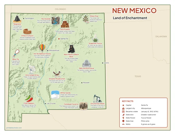
A free printable illustrated map of New Mexico for kids. It shows 8 landmarks and natural places and 3 industries where they really are, along with the state symbols, 6 cities and a box of key facts. It comes in color and in ink-saving black and white, sized for US Letter paper.
downloadColor PDF downloadBlack and white PDF
Choose your version
Color or black and white.
Both are free, sized for US Letter paper, and come as a PDF to print or a PNG image for slides.
Color
The full-color map, for a wall display or a color printer.

Black and white
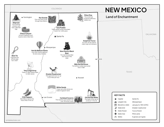
The same map with no color or shading. Prints cleanly on a classroom printer and saves ink.

What is on the New Mexico map
Every picture sits at its real location in New Mexico, with a one-line fact beside it. Santa Fe, the capital, is marked with a star.
Landmarks and natural places
- Shiprock: This towering volcanic rock rises 1,583 feet high.
- Carlsbad Caverns: This massive cave system has over 119 known caves.
- White Sands: These rare white dunes are made of gypsum sand.
- Rio Grande: This river flows south through New Mexico.
- Taos Pueblo: These adobe homes have been lived in for 1,000 years.
- Billy the Kid Grave: The famous outlaw was buried here in 1881.
- Chaco Canyon: Ancient Puebloans built massive stone cities here.
- Hot Air Balloon Fiesta: Over 500 colorful balloons fly here every October.
What New Mexico makes and grows
- Chili Peppers: New Mexico grows the most chiles in the US.
- Very Large Array: These 27 giant dishes listen to radio waves.
- Oil and Gas Wells: This basin is the top oil producer in the US.
State symbols
- Greater Roadrunner: This quick bird can run up to 20 miles per hour.
- Soaptree Yucca: Its roots can be used to make soap and shampoo.
- Piñon Pine: This small tree produces delicious, edible nuts.
- New Mexico Black Bear: The real Smokey Bear was found in this state.
- Bolo Tie: It became the official state tie in 2007.
New Mexico key facts
From the box on the map
- Nickname
- Land of Enchantment
- Capital
- Santa Fe
- Largest city
- Albuquerque
- Became a state
- January 6, 1912 (47th)
- State bird
- Greater roadrunner
- State flower
- Yucca flower
- State tree
- Piñon pine
- Motto
- It grows as it goes
Cities shown
- Santa Fe (capital)
- Albuquerque
- Las Cruces
- Roswell
- Farmington
- Clovis
The outline, rivers and cities are drawn from map data. Pictures of crops and industries are placed in a part of the state where each is typical.