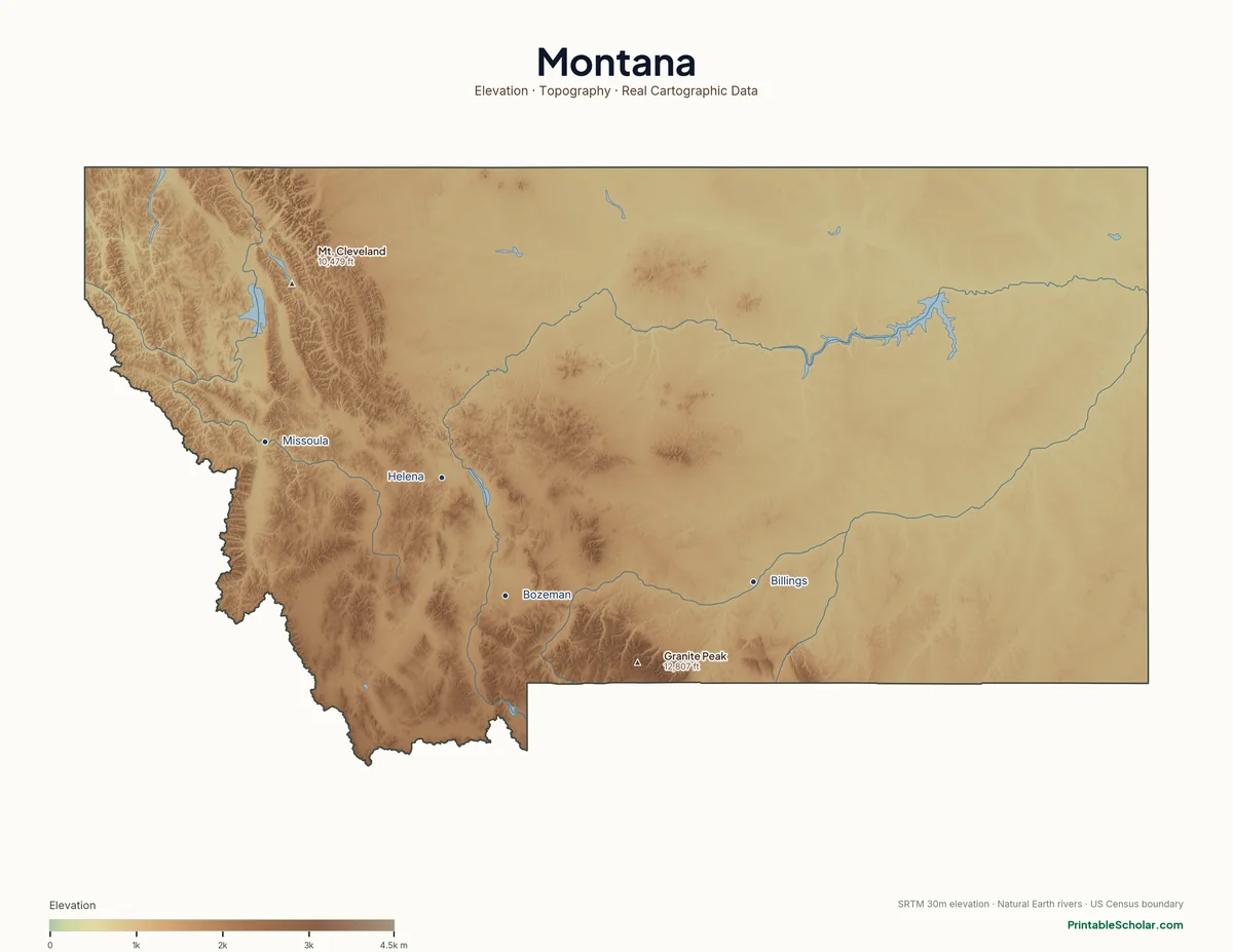
Montana Physical Map
Montana’s western third is mountainous and its eastern two-thirds are plains — the Continental Divide cleaves the state in two.
Rendered from SRTM 30m elevation data + Natural Earth rivers/lakes + US Census state boundary. Three variants below — pick the one that fits your lesson, all free.
Highest Point
Granite Peak
12,807 ft
Lowest Point
Kootenai River
1,800 ft
Choose your version
Three variants from the same data.
Same Montana terrain rendered three different ways for three different uses.
Reference / Curriculum
Featuring the Rocky Mountains, the Bitterroot Range, the Continental Divide, and the Great Plains, with peak names + elevations and major cities labeled. Use this as the "answer key" or wall-poster reference.
download Download PDF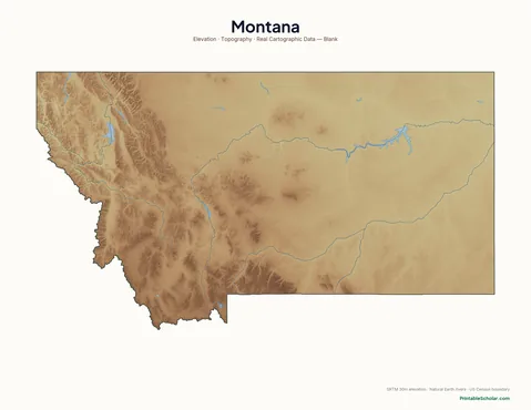
Labeling Exercise
Same Montana terrain, no labels. Have your child identify the major mountain ranges, rivers, and physical features themselves.
download Download PDF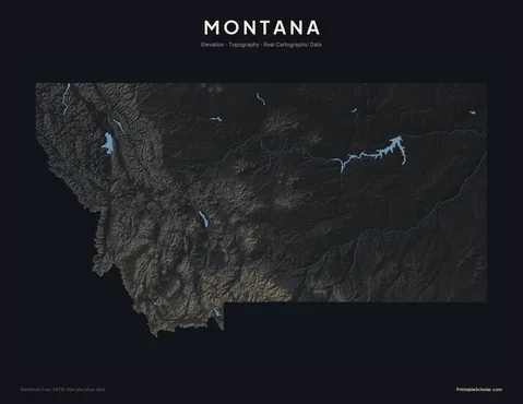
Wall Poster / Pinterest
High-contrast monochrome version. Same elevation data, dramatically rendered for wall-poster use or visual study.
download Download PDFBuilt from real data, not stock images.
Every Montana physical map on this page was rendered from NASA SRTM 30-meter elevation data, with hydrography from Natural Earth and state boundary from US Census TIGER/Line. The terrain texture is real — every ridge, valley, and elevation contour matches what you'd see on a USGS topo map.
Read full methodology arrow_forwardPair with
Montana political map
The blank outline version of Montana (state borders, no terrain). Useful for political-geography exercises.
school4-5 US Geography Pack
Multi-week activity guide. Week 3 covers mountain ranges and rivers — pair this physical map directly into that lesson.
view_listAll physical maps
Browse physical maps for every state, plus continents and the world.