Delaware Landmarks Map
A free printable illustrated map of Delaware for kids. It shows 10 landmarks and natural places and 3 industries where they really are, along with the state symbols, 6 cities and a box of key facts. It comes in color and in ink-saving black and white, sized for US Letter paper.
downloadColor PDF downloadBlack and white PDF
Choose your version
Color or black and white.
Both are free, sized for US Letter paper, and come as a PDF to print or a PNG image for slides.
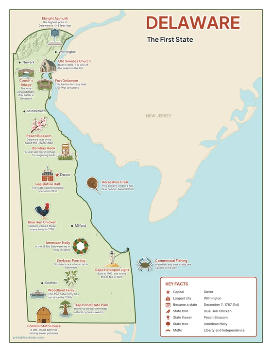
Color
The full-color map, for a wall display or a color printer.

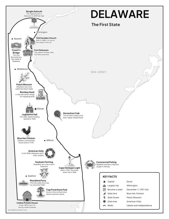
Black and white
The same map with no color or shading. Prints cleanly on a classroom printer and saves ink.

What is on the Delaware map
Every picture sits at its real location in Delaware, with a one-line fact beside it. Dover, the capital, is marked with a star.
Landmarks and natural places
- Ebright Azimuth: The highest point in Delaware is 448 feet high.
- Old Swedes Church: Built in 1698, it is one of the oldest in the US.
- Cooch’s Bridge: The only Revolutionary War battle in Delaware.
- Fort Delaware: This harbor fortress held Civil War prisoners.
- Legislative Hall: The state capitol building opened in 1933.
- Horseshoe Crab: This ancient creature has blue copper-based blood.
- Bombay Hook: A vital salt marsh refuge for migrating birds.
- Woodland Ferry: This free cable ferry has run since the 1740s.
- Trap Pond State Park: Home to the northernmost natural cypress swamp.
- Cape Henlopen Light: Built in 1767, this stone tower fell in 1926.
What Delaware makes and grows
- Collins Potato House: A late-1800s barn for storing sweet potatoes.
- Soybean Farming: Soybeans are a top crop in Delaware.
- Commercial Fishing: Weakfish and blue crabs are caught in the bay.
State symbols
- Blue Hen Chicken: Soldiers carried these brave birds in 1776.
- Peach Blossom: Delaware was once called the Peach State.
- American Holly: In the 1930s Delaware led in holly wreaths.
Delaware key facts
From the box on the map
- Nickname
- The First State
- Capital
- Dover
- Largest city
- Wilmington
- Became a state
- December 7, 1787 (1st)
- State bird
- Blue Hen Chicken
- State flower
- Peach Blossom
- State tree
- American Holly
- Motto
- Liberty and Independence
Cities shown
- Dover (capital)
- Wilmington
- Newark
- Middletown
- Milford
- Seaford
The outline, rivers and cities are drawn from map data. Pictures of crops and industries are placed in a part of the state where each is typical.