Arizona Landmarks Map
A free printable illustrated map of Arizona for kids. It shows 8 landmarks and natural places and 3 industries where they really are, along with the state symbols, 6 cities and a box of key facts. It comes in color and in ink-saving black and white, sized for US Letter paper.
downloadColor PDF downloadBlack and white PDF
Choose your version
Color or black and white.
Both are free, sized for US Letter paper, and come as a PDF to print or a PNG image for slides.
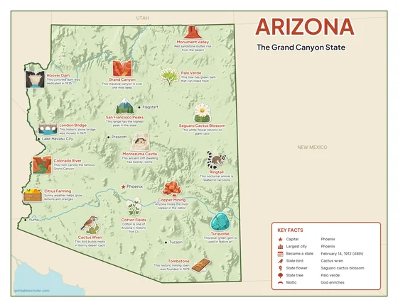
Color
The full-color map, for a wall display or a color printer.

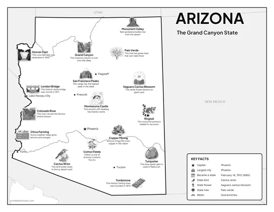
Black and white
The same map with no color or shading. Prints cleanly on a classroom printer and saves ink.

What is on the Arizona map
Every picture sits at its real location in Arizona, with a one-line fact beside it. Phoenix, the capital, is marked with a star.
Landmarks and natural places
- Grand Canyon: This massive canyon is over one mile deep.
- Colorado River: This river carved the famous Grand Canyon.
- Monument Valley: Red sandstone buttes rise from the desert.
- San Francisco Peaks: This range has the highest peak in the state.
- Hoover Dam: This concrete dam was dedicated in 1935.
- London Bridge: This historic stone bridge was moved in 1971.
- Montezuma Castle: This ancient cliff dwelling has twenty rooms.
- Tombstone: This historic mining town was founded in 1879.
What Arizona makes and grows
- Copper Mining: Arizona mines the most copper in the nation.
- Citrus Farming: Sunny weather helps grow lemons and oranges.
- Cotton Fields: Cotton is one of Arizona’s historic five Cs.
State symbols
- Cactus Wren: This bird builds nests in thorny desert cacti.
- Saguaro Cactus Blossom: This white flower blooms on giant cacti.
- Palo Verde: This tree has green bark that can make food.
- Turquoise: This blue-green gem is used in Native art.
- Ringtail: This nocturnal animal is related to raccoons.
Arizona key facts
From the box on the map
- Nickname
- The Grand Canyon State
- Capital
- Phoenix
- Largest city
- Phoenix
- Became a state
- February 14, 1912 (48th)
- State bird
- Cactus wren
- State flower
- Saguaro cactus blossom
- State tree
- Palo verde
- Motto
- God enriches
Cities shown
- Phoenix (capital)
- Tucson
- Flagstaff
- Yuma
- Lake Havasu City
- Prescott
The outline, rivers and cities are drawn from map data. Pictures of crops and industries are placed in a part of the state where each is typical.