Free Printable Kansas Map with Cities
Free printable map of Kansas showing major cities, the state capital Topeka, and county boundaries. Perfect for geography study, classroom use, and reference.
About This Kansas Map
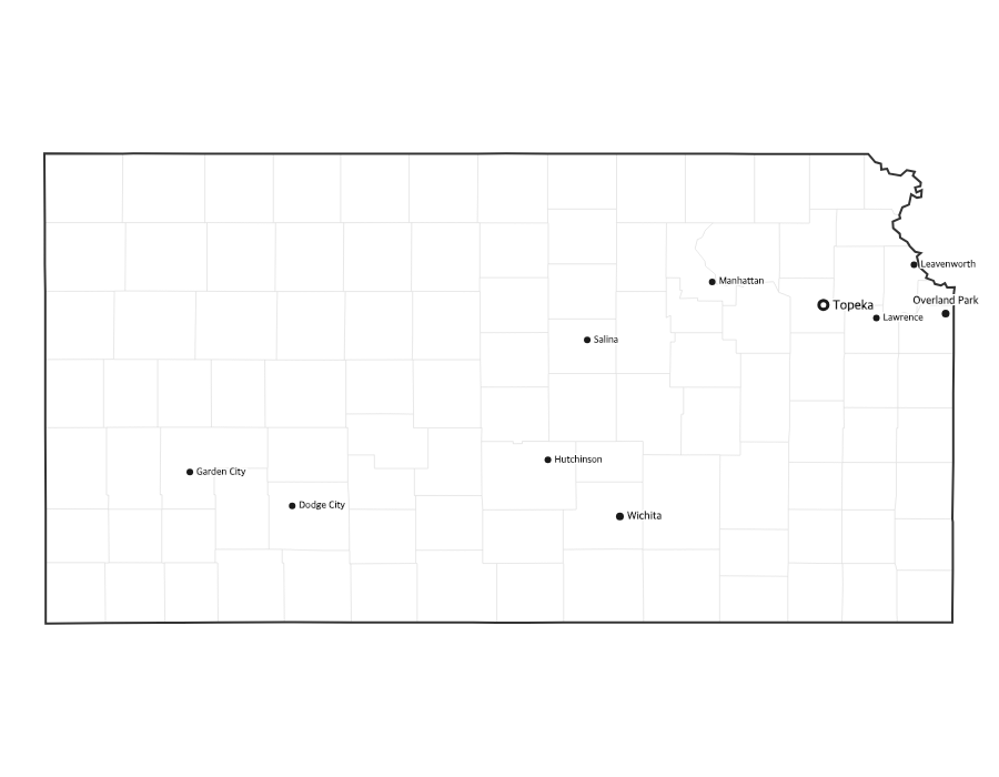
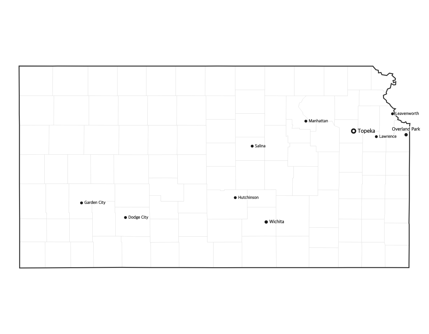
This free printable map of Kansas shows the state's major cities, including Wichita, Overland Park, Kansas City, Olathe, Topeka, along with the state capital Topeka (marked in red). County boundaries are shown as light lines for geographic context. Kansas, known as the "Sunflower State," has 105 counties.
How to Print
Click "Download PDF" for a print-ready file that automatically fits US Letter paper (8.5" × 11") with proper margins. Or download the high-resolution PNG to use in presentations, worksheets, or other documents.
Classroom Ideas
Use this map as a study reference or desk reference for Kansas geography. Pair it with our blank Kansas map for testing — students label cities and the capital from memory, then check against this reference.
Cities on This Kansas Map
This map labels the largest cities in Kansas, including Wichita (the state's biggest city), the Kansas City metro suburbs of Overland Park, Olathe, Shawnee, and Lenexa, plus the state capital Topeka and the university town of Lawrence. The capital is marked with a red dot so students can find it at a glance.
Kansas Geography at a Glance
Kansas sits in the Great Plains of the American Midwest, bordered by Nebraska to the north, Missouri to the east, Oklahoma to the south, and Colorado to the west. The land rises gradually from the tallgrass Flint Hills in the east to the High Plains in the west, drained by the Kansas (Kaw) and Arkansas rivers. Kansas is also home to the geographic center of the 48 contiguous United States, near the town of Lebanon.
Teaching Ideas for This Map
Have students trace Interstate 70 from Kansas City to the Colorado line, locate the capital and their nearest city, or shade the Flint Hills and High Plains regions. Pair this reference with the blank Kansas map so learners can label all 105 counties and the capital from memory, then self-check.
Frequently Asked Questions
What are the largest cities in Kansas?
The largest cities in Kansas by population include Wichita, Overland Park, Kansas City, Olathe, Topeka. The state capital is Topeka.
What is the capital of Kansas?
The capital of Kansas is Topeka. It is marked with a red dot on this map.
What paper size should I use?
This map is designed for standard US Letter paper (8.5" × 11"). The PDF download automatically fits the map to your page with proper margins.
How many counties does Kansas have?
Kansas has 105 counties. The state capital, Topeka, is located in Shawnee County in the northeastern part of the state.
What region of the United States is Kansas in?
Kansas is in the Midwest, within the Great Plains. It borders Nebraska, Missouri, Oklahoma, and Colorado.
Where is the geographic center of the contiguous United States?
The geographic center of the 48 contiguous states is in Kansas, near the town of Lebanon in the north-central part of the state.