Map packs by grade level.
Each pack: curated maps from our library + a multi-week activity guide aligned to the appropriate grade-level standards. Pick the level that matches your child or work through them in sequence over multiple years.
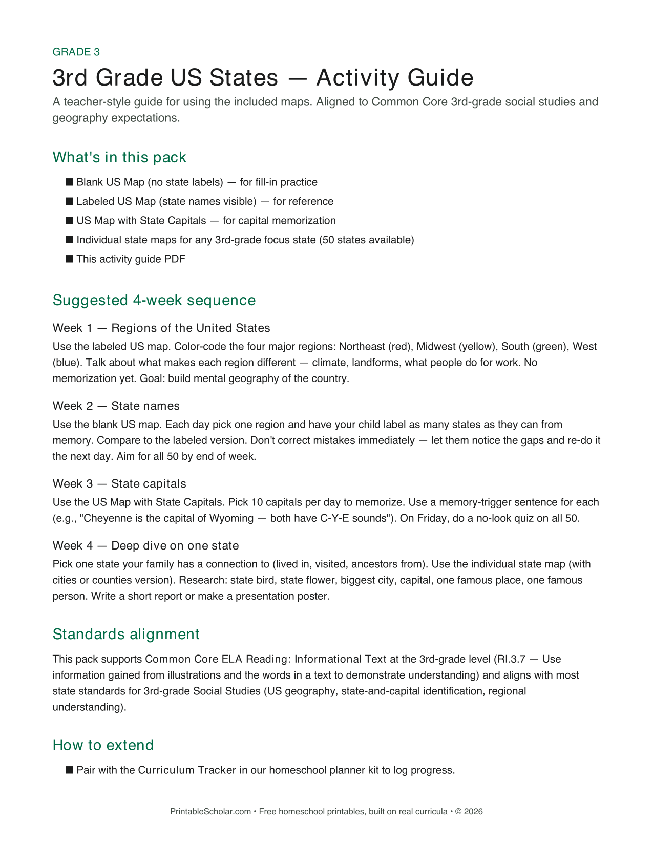
3rd Grade US States Map Pack
Everything a 3rd grader needs to learn the 50 US states and their capitals. Three reference maps, a 4-week activity guide, and any individual state map you want to deep-dive on.
Open pack arrow_forward
K-2 World Explorer Map Pack
A starter geography pack for K-2 homeschool families. Continents, oceans, and the basic shape of the world — without the memorization pressure that comes later.
Open pack arrow_forward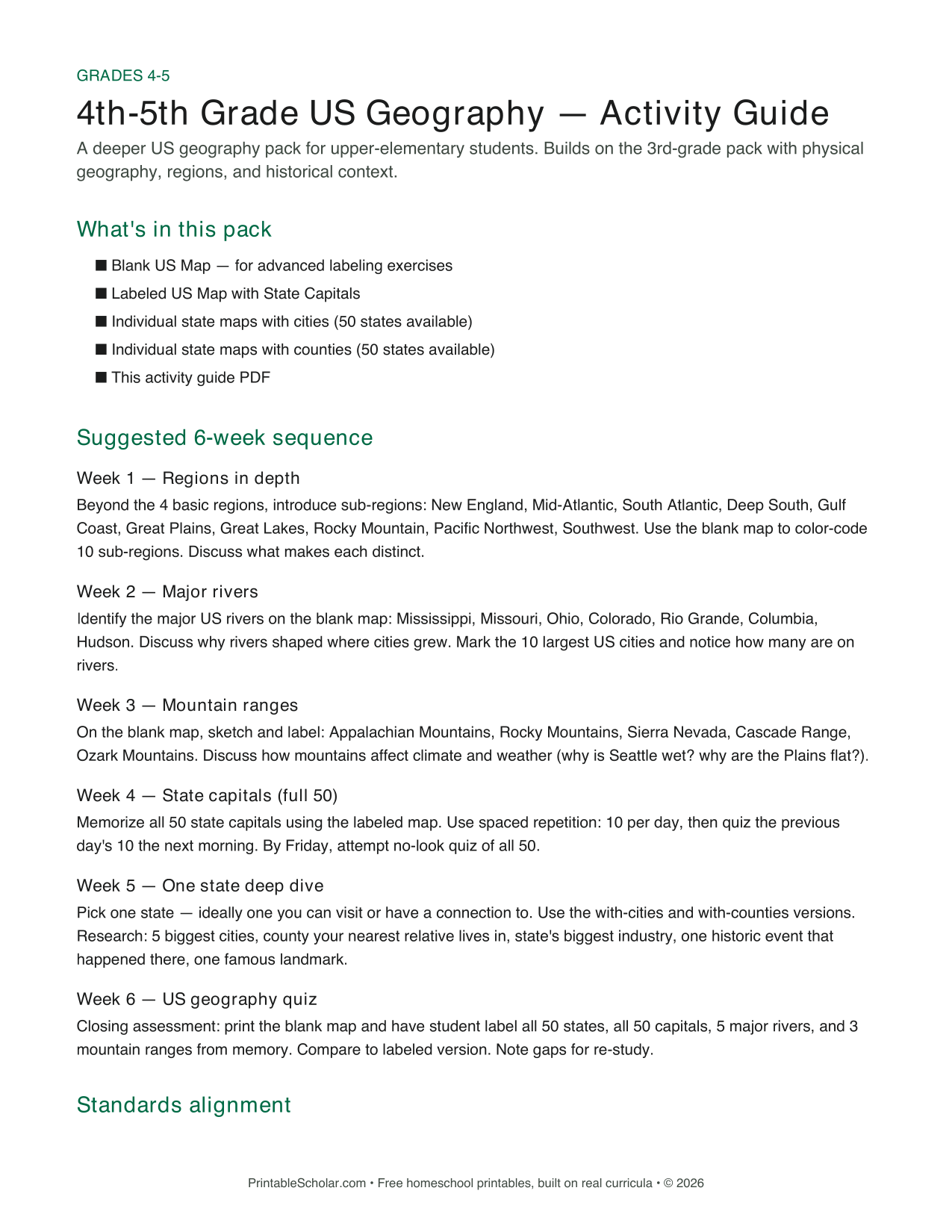
4th-5th Grade US Geography Pack
A deeper US geography pack for upper-elementary students. Builds on 3rd-grade work with regions, rivers, mountain ranges, and a one-state deep dive.
Open pack arrow_forward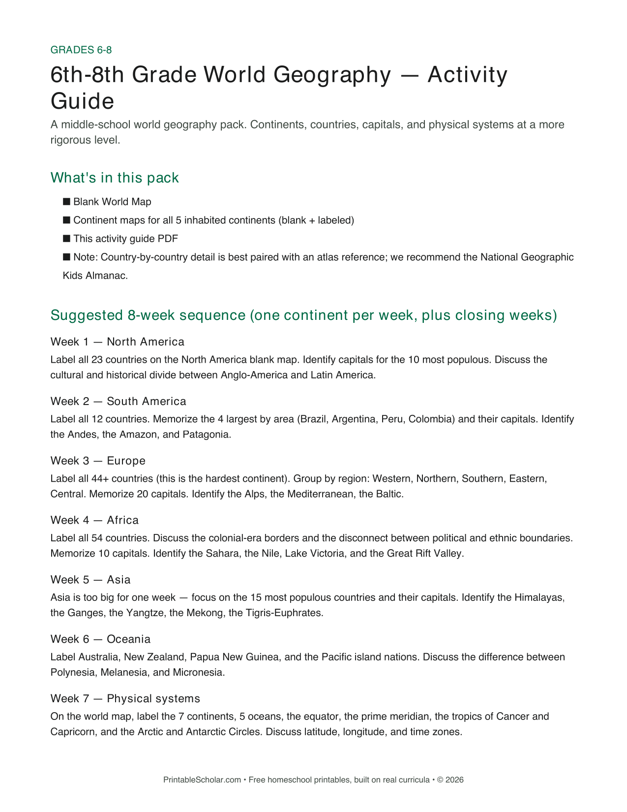
6th-8th Grade World Geography Pack
A middle-school world geography pack covering all seven continents in eight weeks. Continents, countries, capitals, and physical systems at a more rigorous level.
Open pack arrow_forwardHow the packs work
Pick your grade
K-2, Grade 3, Grades 4-5, or Grades 6-8. Pack difficulty matches what each grade is developmentally ready for.
Print the maps + guide
Each pack page links to the curated maps. Download the activity guide PDF. No sign-up, no email collection, no watermarks.
Follow the sequence
Each guide has a multi-week sequence (4-8 weeks depending on grade) with daily activity suggestions and standards alignment.
Why grade-leveled?
Most "kids printable maps" sites are a flat library — every map sits at the same level, with no guidance on which to use when. That works if you already know what you’re doing.
For new homeschool families, or for families introducing geography for the first time, that’s overwhelming. Grade-level packs solve the "where do I start" problem: pick your grade, get a curated set, follow the multi-week sequence.
Standards alignment isn’t about replacing classroom curriculum — it’s about making sure what we recommend matches what most state requirements expect at each grade band. Common Core ELA Reading: Informational Text covers the underlying skill (reading maps as informational sources) for all four packs.