How to Teach the 50 States and Capitals (Region by Region)
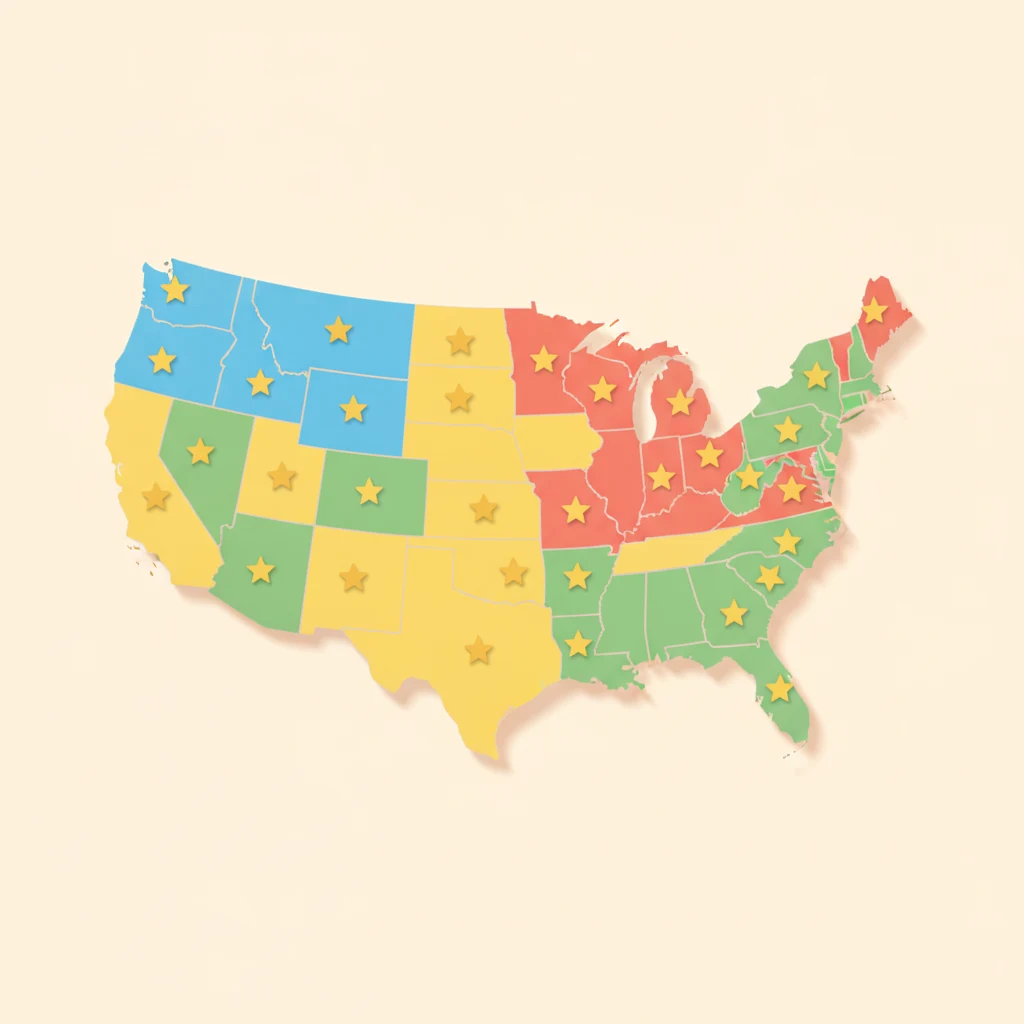
The list of 50 states and capitals is one of the few things in a homeschool that you can teach once and be done with. It doesn't get revised. The last time a U.S. state capital moved was 1910, when Oklahoma shifted its seat to Oklahoma City. Since then the answer key has been frozen — which means the effort you put in now pays off for the rest of your child's life.
So it's worth doing well. And "well" almost never means the way most kids are handed it: a printed alphabetical list, Alabama through Wyoming, to be recited. That order is the problem. Below is the plan we'd hand a homeschool parent — grouped by region, built on blank maps, and paced so it actually sticks.
Why the alphabetical list fails
An A-to-Z list asks a child to memorize 50 unconnected facts in an order that means nothing. Alabama sits next to Alaska on the page, but they're 3,000 miles apart in reality — so the sequence teaches a false neighbor and gives the brain nothing real to hang each state on. When items have no meaning and no structure, they interfere with each other, and recall collapses under its own weight.
Geography has a built-in structure the alphabet throws away: states are next to each other. Learning them by region uses that structure. Three well-replicated findings from cognitive science line up behind this approach — and the point isn't that a region is magic, it's that a region lets you apply all three at once, which a bare alphabetical list does not:
- Chunking. Working memory holds only a handful of items at a time. Grouping the 50 states into five regions of roughly 10 turns one impossible pile into five manageable ones. (This is the classic memory-capacity insight George Miller described in the 1950s.)
- Spaced practice. Reviewing a little each day over weeks produces far more durable memory than one long cram — the "spacing effect," among the most robustly replicated results in learning research since Hermann Ebbinghaus first measured it in 1885.
- Retrieval practice. Filling in a blank map from memory beats re-reading a labeled one. The act of pulling a fact out of your head — the "testing effect" — strengthens it; passively re-reading creates a feeling of knowing that doesn't survive to next week.
Compared with rote recitation of an alphabetical list, a plan built on all three tends to hold up better weeks later — not because regions are special, but because the list format quietly blocks every one of these mechanisms.
Step 1: Chunk the map into five regions
Print a labeled U.S. map and a blank U.S. map to work from. Then split the country into five regions. There's no single official version — the U.S. Census Bureau uses four regions and nine divisions for its own statistics, and textbooks draw the lines slightly differently — so the rule is simply: pick one grouping and stay consistent. Here's a clean five-region split that covers all 50 states exactly once:
Northeast (11 states)
| State | Capital | State | Capital |
|---|---|---|---|
| Maine | Augusta | New Jersey | Trenton |
| New Hampshire | Concord | Pennsylvania | Harrisburg |
| Vermont | Montpelier | Delaware | Dover |
| Massachusetts | Boston | Maryland | Annapolis |
| Rhode Island | Providence | New York | Albany |
| Connecticut | Hartford |
Southeast (12 states)
| State | Capital | State | Capital |
|---|---|---|---|
| Virginia | Richmond | Florida | Tallahassee |
| West Virginia | Charleston | Alabama | Montgomery |
| Kentucky | Frankfort | Mississippi | Jackson |
| Tennessee | Nashville | Arkansas | Little Rock |
| North Carolina | Raleigh | Louisiana | Baton Rouge |
| South Carolina | Columbia | Georgia | Atlanta |
Midwest (12 states)
| State | Capital | State | Capital |
|---|---|---|---|
| Ohio | Columbus | Iowa | Des Moines |
| Michigan | Lansing | Missouri | Jefferson City |
| Indiana | Indianapolis | North Dakota | Bismarck |
| Illinois | Springfield | South Dakota | Pierre |
| Wisconsin | Madison | Nebraska | Lincoln |
| Minnesota | Saint Paul | Kansas | Topeka |
Southwest (4 states)
| State | Capital | State | Capital |
|---|---|---|---|
| Arizona | Phoenix | Oklahoma | Oklahoma City |
| New Mexico | Santa Fe | Texas | Austin |
West (11 states)
| State | Capital | State | Capital |
|---|---|---|---|
| Colorado | Denver | Utah | Salt Lake City |
| Wyoming | Cheyenne | California | Sacramento |
| Montana | Helena | Nevada | Carson City |
| Idaho | Boise | Alaska | Juneau |
| Washington | Olympia | Hawaii | Honolulu |
| Oregon | Salem |
Step 2: The weekly rhythm
Do one region per week. Each week has the same simple shape — introduce, then recall, then review everything old:
| Week | New region | Daily review (5 min) |
|---|---|---|
| 1 | Northeast | — |
| 2 | Southeast | Northeast |
| 3 | Midwest | Northeast + Southeast |
| 4 | Southwest | Northeast → Midwest |
| 5 | West | All four earlier regions |
| 6+ | — | Full blank-map check, once a week |
That "daily review" column is the spacing effect doing its quiet work. Every region you've already learned gets a brief touch each day, so nothing has time to fade before it comes around again. It's a few minutes, not a study session.
Step 3: Introduce, then go blind
The order within each region is what makes it work. Never start with the blank map — start by looking, then take the labels away:
- Introduce with a labeled map. Point to each state in the week's region on the labeled map, say its name and capital, trace its borders with a finger. This is the encoding step — the child needs to see the thing before they can recall it.
- Fill in a blank map from memory. Hand over a fresh blank map and have them write in just this region's states and capitals without looking. Struggling to remember is the learning — don't rescue too fast.
- Self-check against the answer key. The labeled map is the answer key. Even better for capitals, the U.S. map with capitals shows every capital in place, so a child can grade their own blank map and see exactly which ones to fix.
For a region a child keeps missing, zoom in. The individual blank state maps — a single blank Texas or blank California on its own sheet — are useful for drilling a stubborn shape or letting a younger child color one state at a time before it joins the crowd.
Step 4: Handle the capitals that trip everyone up
Most capital mistakes come from one wrong assumption: that the capital is the biggest, most famous city. Usually it isn't — capitals were often placed in a central or smaller town on purpose. Teach these mismatches head-on and you'll knock out the majority of errors before they start:
| State | The capital is… | Not the famous city… |
|---|---|---|
| New York | Albany | New York City |
| California | Sacramento | Los Angeles |
| Illinois | Springfield | Chicago |
| Pennsylvania | Harrisburg | Philadelphia |
| Washington | Olympia | Seattle |
| Florida | Tallahassee | Miami |
| Missouri | Jefferson City | St. Louis / Kansas City |
Say the rule out loud once — "the capital is often not the city you've heard of" — and let the child hunt for the trick capitals themselves. Turning it into a spot-the-catch game makes the exceptions memorable instead of frustrating.
Where this fits in a geography year
The 50 states are the natural on-ramp to the rest of geography, because the map skill you're building — introduce on a labeled map, recall on a blank one, review on a spacing schedule — is the same skill you'll reuse for continents and countries. When your child has the states down, the identical method scales straight up to world geography; our six-week Asian geography map curriculum runs on exactly this rhythm. Same three habits, bigger map.
Start this week: print the labeled map and a stack of blank ones, introduce the Northeast today, and fill in your first blank map tomorrow. Five short weeks from now, the whole country is done — and it stays done.