Free Printable Indiana Map with Counties
Free printable map of Indiana with all 92 county boundaries labeled. Shows the state capital Indianapolis and county names. Perfect for geography study and classroom use.
About This Indiana Map
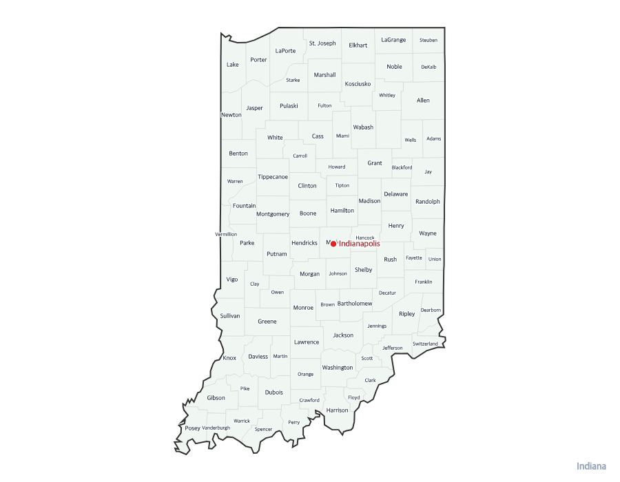
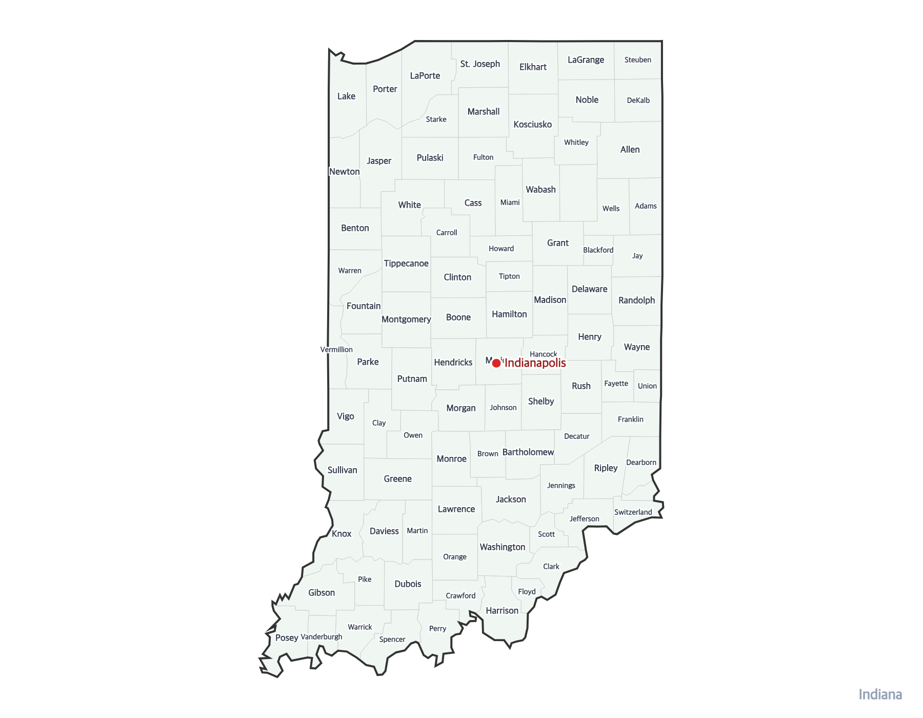
This free printable labeled map of Indiana shows all 92 county boundaries with names labeled. Indiana, known as the "Hoosier State," has its capital in Indianapolis. The capital is marked with a red dot for easy identification.
How to Print
Click "Download PDF" for a print-ready file that automatically fits US Letter paper (8.5" × 11") with proper margins. Or download the high-resolution PNG to use in presentations, worksheets, or other documents.
Classroom Ideas
Use this labeled map as a study reference or answer key. Pair it with our blank Indiana map for testing — students label counties from memory, then check against this reference. Great for state history and geography units.
Frequently Asked Questions
How many counties does Indiana have?
Indiana has 92 counties. All are shown on this printable map with clear boundary lines.
What is the capital of Indiana?
The capital of Indiana is Indianapolis. It is marked with a red dot on this map.
What paper size should I use?
This map is designed for standard US Letter paper (8.5" × 11"). The PDF download automatically fits the map to your page with proper margins.