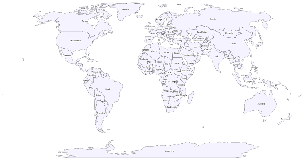
Free Printable Labeled World Map
Free printable world map with country names labeled. A clean reference map for geography study, classroom use, and educational projects.
About This World Map
Free printable world map with country names labeled. A clean reference map for geography study, classroom use, and educational projects.
How to Use
Print this world map on standard US Letter paper (8.5" × 11") in landscape orientation. The Natural Earth projection provides a balanced view of all continents. Click "Download PDF" for a print-ready file, or "Download PNG" for the image.
Frequently Asked Questions
Are all countries labeled?
The largest and most commonly studied countries are labeled directly on the map. Very small countries and island nations may not have labels due to space constraints, but their outlines are still shown.
Is this good for a desk reference?
Absolutely — the clean design with readable labels makes it perfect as a desk reference map. Many teachers laminate a copy for each student's desk.
Can I print this on regular paper?
Yes, this map is optimized for standard US Letter paper (8.5" × 11") in landscape orientation. The labels are sized to remain readable at this print size.