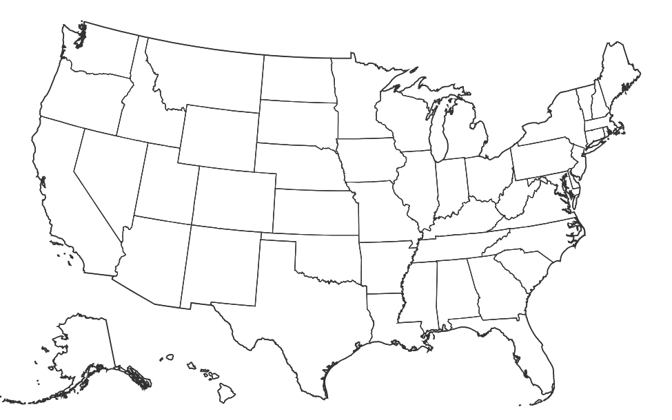
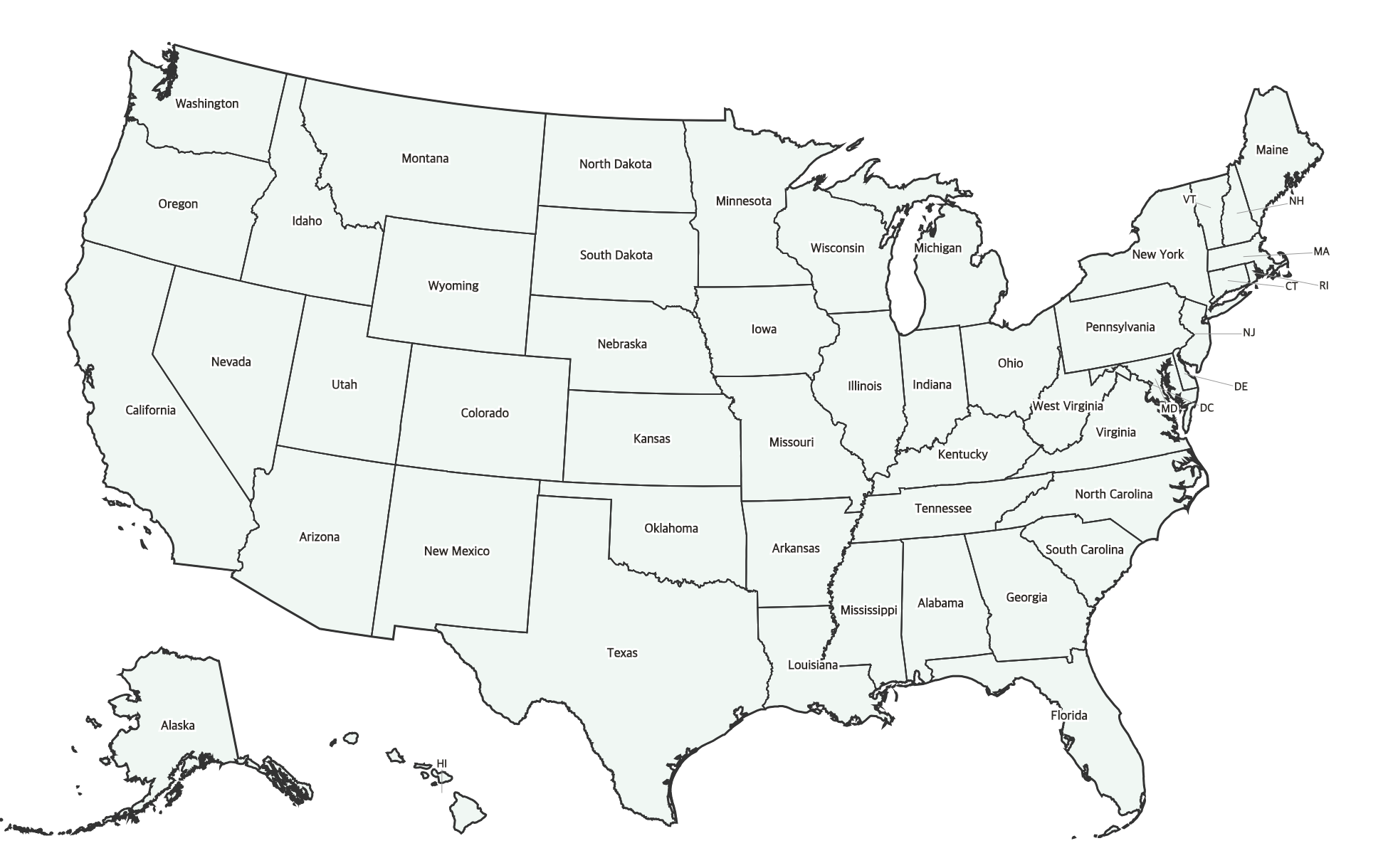
Free Printable Labeled Map of the United States
Free printable map of the United States with all 50 state names labeled. Clean, classroom-ready design for geography study and reference.

About This US Map
Free printable map of the United States with all 50 state names labeled. Clean, classroom-ready design for geography study and reference.
How to Use
Print this map on standard US Letter paper (8.5" × 11") in landscape orientation for the best results. Click "Download PDF" for a print-ready file that automatically fits your page, or "Download PNG" for the high-resolution image file.
Frequently Asked Questions
Are all 50 states labeled on this map?
Yes — all 50 states are clearly labeled. Smaller northeastern states use standard two-letter abbreviations for readability, with a legend included.
Can I use this as a study reference?
This labeled map is designed as a study reference. Students can use it alongside a blank map to check their answers, or keep it as a desk reference while learning US geography.
Is this map good for wall display?
Yes! The clean design prints well at full page size. For a larger poster, print at 150% or 200% on larger paper, or use your printer's poster/tiling mode.