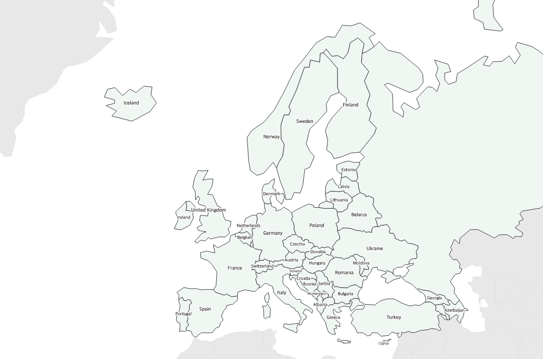
Free Printable Labeled Map of Europe
Free printable map of Europe with all country names labeled. A clean reference map for geography study, classroom use, and educational projects.
About This Europe Map
Free printable map of Europe with all country names labeled. A clean reference map for geography study, classroom use, and educational projects.
How to Use
Print this Europe map on standard US Letter paper (8.5" × 11") in landscape orientation. Click "Download PDF" for a print-ready file that automatically fits your page, or "Download PNG" for the high-resolution image file. Neighboring regions are shown in light gray for geographic context.
Frequently Asked Questions
Are all European countries labeled?
Yes — all major European countries are clearly labeled on the map. Very small countries like Andorra, Liechtenstein, and San Marino may use abbreviated labels due to space.
Is this good for a desk reference?
Absolutely — the clean design with readable labels makes it ideal as a desk reference for students learning European geography.
Does this include Russia?
The map shows the western portion of Russia that is geographically part of Europe, along with Turkey's European territory.